Overview
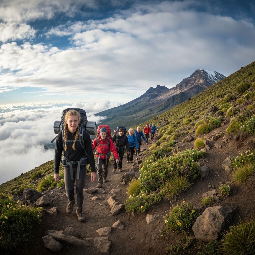
The Rongai Route is the only path up Kilimanjaro that approaches from the north, climbing the dry, quiet, almost forgotten Kenyan side of the mountain. Over six days you cross from the pine forests near the Kenyan border at 1,950m to the snow-rimmed crater at 5,895m, sleeping in tented camps and descending the busier Marangu trail on the south side. Among the standard routes it is the least crowded, the driest, and arguably the most varied in scenery - the northern slopes are an entirely different ecosystem than the southern rainforest most trekkers know.
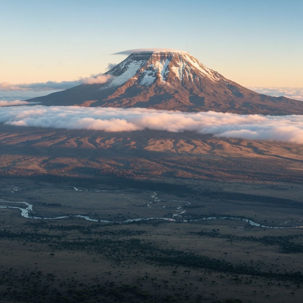
The pitch is honest. Rongai sits at about 75 percent summit success on the 6-day variant - better than 5-day Marangu (65 percent) but below 7-day Machame (85 percent) or 8-day Lemosho (95 percent). You'll trade some summit probability for solitude and a fundamentally different feel. The first three days you may walk for hours without crossing another group, and entire camps belong to your crew alone. Day 3 climbs to Mawenzi Tarn at 4,330m, an alpine lake cupped in the cirque at the foot of Mawenzi's vertical spires - one of the most photogenic camps on the mountain and a built-in acclimatization halt. Summit night is the same as every other route: a midnight start from Kibo Hut, -10C to -20C with wind chill, 1,200m of black volcanic scree under head-torch beams, six to seven hours of zig-zags before sunrise at Gilman's Point on the crater rim. The descent shares the Marangu trail, so your final two days run down the south side through Horombo Hut to the rainforest gate.
You are guaranteed pine and podocarp forest on Day 1, the open moorland of Kikelewa with Mawenzi rising larger every step, Mawenzi Tarn itself with the peak reflected in the water at dawn, the lunar Saddle - a 4,400m alpine desert plateau strung between Mawenzi and Kibo - and Uhuru Peak at 5,895m. The receding Northern Icefields hang at arm's length from the summit, and on the way up to Gilman's you climb directly into them.
If you're lucky, you'll see fresh elephant or buffalo tracks on Day 1 (rare on the south but real here - the dry northern slopes hold more megafauna), a Lammergeier above Mawenzi's cliffs, klipspringer at the tarn, and on a clear morning Mt. Kenya 250km to the north, a dark sawtooth on the horizon.
The payoff is two-fold: Gilman's Point at sunrise like every Kilimanjaro climber, but also the quieter, more authentic week underneath. Rongai is the route we recommend to travelers who don't want to be in a queue, who want to see a side of the mountain few people see, and who can accept slightly lower summit odds for a much better trekking experience along the way.
The pitch is honest.
What to Expect
Rongai is the route we recommend to travelers who do not want to be in a queue. The first three days are some of the quietest walking on Kilimanjaro - you may go entire half-days without crossing another group, and the camps at Simba and Kikelewa often belong to your crew alone. The scenery is fundamentally different from the southern routes: dry pine and podocarpus forest instead of dripping rainforest on Day 1, then open moorland with the Kenyan plains rolling away behind you, then the dramatic cirque under Mawenzi where you spend Day 3. Mawenzi Tarn at 4,330m is one of the most photogenic camps on the whole mountain - an alpine lake mirrored by Mawenzi's vertical spires - and it doubles as a built-in acclimatization halt with an afternoon climb-high-sleep-low walk.
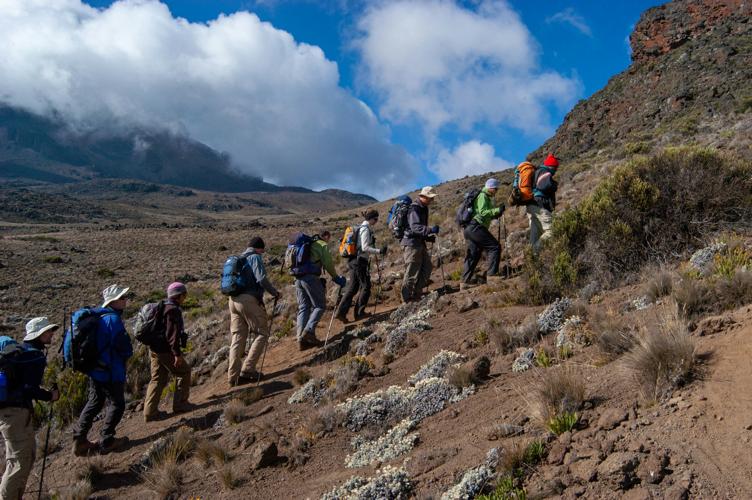
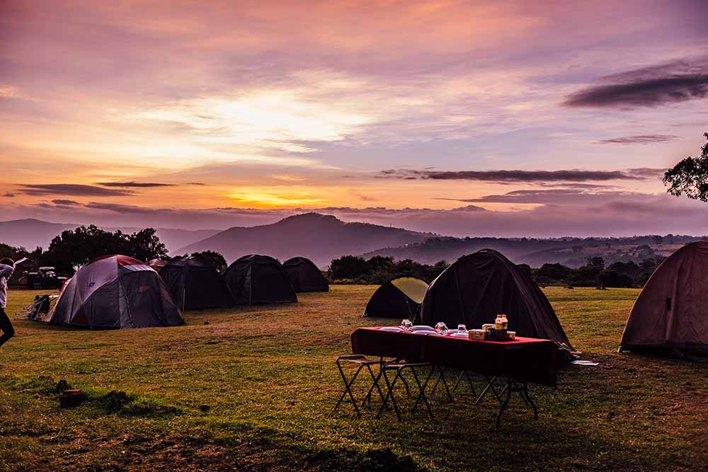
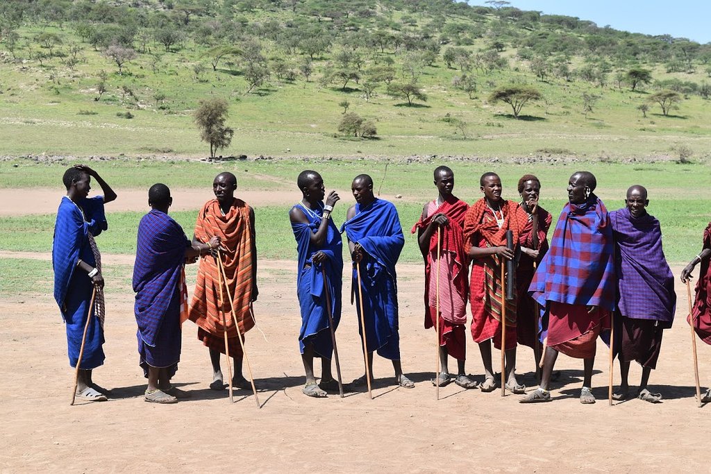
You sleep in tents the whole way. Our standard tents are four-season Mountain Hardwear or equivalent dome tents, pitched two to a tent with a four-inch foam pad. A separate mess tent serves as dining room. Food is better than you expect: hot porridge and eggs for breakfast, sandwiches and soup on the trail, popcorn and ginger tea at the afternoon stop, and a hot two-course dinner served every night - rice or pasta or ugali with vegetable stew, fresh fruit, sometimes fish. We provide a private portable toilet tent - one of the small luxuries that makes the trek dramatically more comfortable. The crew is what really makes it work. For every trekker you have roughly three porters, plus a cook, an assistant guide, and a lead guide. They overtake you on the trail carrying 20kg loads on their heads.
The northern slope has noticeably more wildlife than the south, particularly at lower altitudes. Fresh elephant and buffalo tracks across the Day 1 trail are common, the occasional bushbuck disappears into the brush, and klipspringer cross the Saddle on Day 4. Lammergeier may circle Mawenzi's cliffs. Altitude starts as a faint dullness around Kikelewa on Day 2. By the Saddle on Day 4 it has settled into a slow heavy fog - you walk slower, eat less, sleep poorly. On summit night somewhere between Kibo and Gilman's you will doubt everything you have ever done. And then at Gilman's, with the sun coming up over Mawenzi - now far below you - you will not. Be honest about the success rate: 75 percent on 6-day Rongai means one in four trekkers turns back. Most failures happen on the climb to Gilman's, almost always to acute mountain sickness rather than fitness. Our guides are KPAP-registered Tanzanians who have summited 100, 200, sometimes 500 times. Trust them when they say slow down. They still call her Mama.
Rongai is the route we recommend to travelers who do not want to be in a queue.
Itinerary
A walk through the route, with distances, hike times and where you'll sleep.
Nale Moru Gate to Simba Camp
Your trek begins with a long 3 to 4-hour vehicle transfer from Moshi around the eastern flank of the mountain to Nale Moru Gate at 1,950m on the Kenyan border side. Park registration takes about an hour - your guide handles the paperwork while you meet the porters. The trail leaves the gate under cool, open pine and podocarpus forest, fundamentally different from the steamy southern rainforest. There is no canopy drip here, no curtain of moss - just tall straight conifers, dry needles underfoot, and shafts of equatorial sun cutting between the trunks. The grade is gentle: about 675m of elevation gain over 8 kilometres in three to four unhurried hours. Keep your eyes open at the lower altitudes - the dry north side holds more wildlife than the south, and you may find fresh elephant or buffalo tracks crossing the path, occasional bushbuck disappearing into the brush, vervet monkeys higher up the slope. You arrive at Simba Camp (2,625m) by mid-afternoon to find your tents already pitched in a forest clearing, hot washing water set out, and a kettle whistling in the mess tent. Dinner is typically cucumber soup, rice or pasta with a vegetable stew, fresh fruit, and hot ginger tea. The night is quiet in a way that the southern routes are not.
- Quiet pine forest unlike the southern rainforest
- Possible elephant or buffalo tracks
- Simba Camp practically to yourselves
Simba Camp to Kikelewa Camp
The longest day on the route. You leave the forest within the first hour as the trail climbs out into open moorland, and the whole sky opens up at once - on a clear morning the jagged spires of Mawenzi appear dead ahead, growing larger with every step, and the Kenyan plains roll away behind you to the north. This zone belongs to the giant endemic flora: senecios that look like five-metre cabbages on stalks, lobelias spiked like prehistoric pineapples, everlasting flowers that crackle underfoot. The trail crosses several dry stream beds and climbs steadily through heather taller than a person. The grade is moderate but persistent: roughly 1,025m of vertical gain over 12 kilometres takes six to seven hours, and the air noticeably thins as you cross 3,500m. You'll likely walk all day without seeing another group. Kikelewa Camp (3,650m) sits in a sheltered hollow on the moorland, with Mawenzi towering directly above to the west and the Saddle visible in the distance. The wind picks up after sunset. Pack into your sleeping bag warm.
- Open views of Mawenzi from below
- Giant senecios and lobelias
- Sheltered camp with the Kenyan plains stretching north
Kikelewa Camp to Mawenzi Tarn
A deliberately short day, and arguably the most spectacular camp on the mountain. The trail climbs steadily for four to five hours over rocky terrain into the cirque - the bowl-shaped glacial valley - directly below Mawenzi's vertical spires. Halfway up the wall of Mawenzi suddenly appears as a near-vertical rampart of black basalt and ice, fluted with couloirs, dropping a thousand metres above the trail. You round a bend and step into the cirque to find Mawenzi Tarn (4,330m) - a small alpine lake cupped in the rock, fed by snow melt, with the peak reflected on a still morning. The camp sits on grassy moraine ten minutes from the water's edge. This is your built-in acclimatization day: you've gained 680m and stopped early, giving your body hours to adjust before tomorrow's push to Kibo. Most groups do a short walk in the afternoon onto the lower slopes of Mawenzi proper, climbing perhaps another 200m to about 4,500m and returning to sleep at 4,330m - a textbook climb-high-sleep-low cycle. Sunset turns the tarn copper.
- Mawenzi Tarn - an alpine lake at 4,330m
- Mawenzi's vertical rampart directly above camp
- Acclimatization walk in the afternoon
Mawenzi Tarn to Kibo Hut
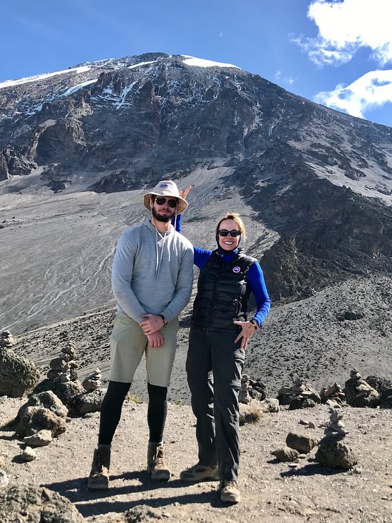
Today you cross the Saddle - the lunar plateau strung at 4,400m between the volcanic spires of Mawenzi behind you and the glaciated dome of Kibo ahead. The trail leaves Mawenzi Tarn climbing gently out of the cirque, then levels onto an utterly barren expanse of black gravel, basalt and sky. No trees, no grass, almost no plants beyond the occasional everlasting clinging to a rock. The crossing takes four to five hours over 9 kilometres, with only 390m of net gain, but the altitude makes every step feel like more. Klipspringer occasionally cross the Saddle, and Lammergeier may circle overhead. By midday you'll see Kibo Hut as a small grey square against the eastern flank of the summit cone - it takes another hour to reach. The hut sits at 4,720m on the same site shared by the Marangu route, a stone shelter that looks like it was built into the mountain. You arrive in the early afternoon, eat an early hot meal, and try to sleep from 6pm. You won't really sleep - altitude, cold, anticipation. At 11pm a porter brings tea and a biscuit. Summit night begins at midnight.
- Crossing the lunar Saddle at 4,400m
- Mawenzi receding behind, Kibo growing ahead
- Final altitude prep at Kibo Hut
Summit Day: Kibo Hut to Uhuru Peak to Horombo Hut
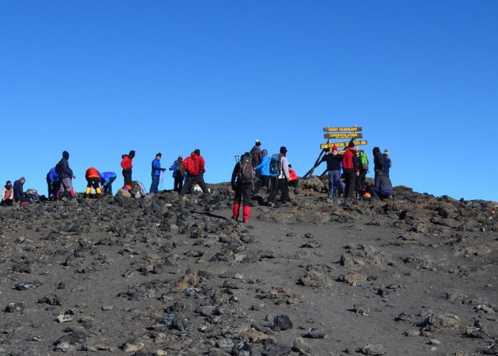
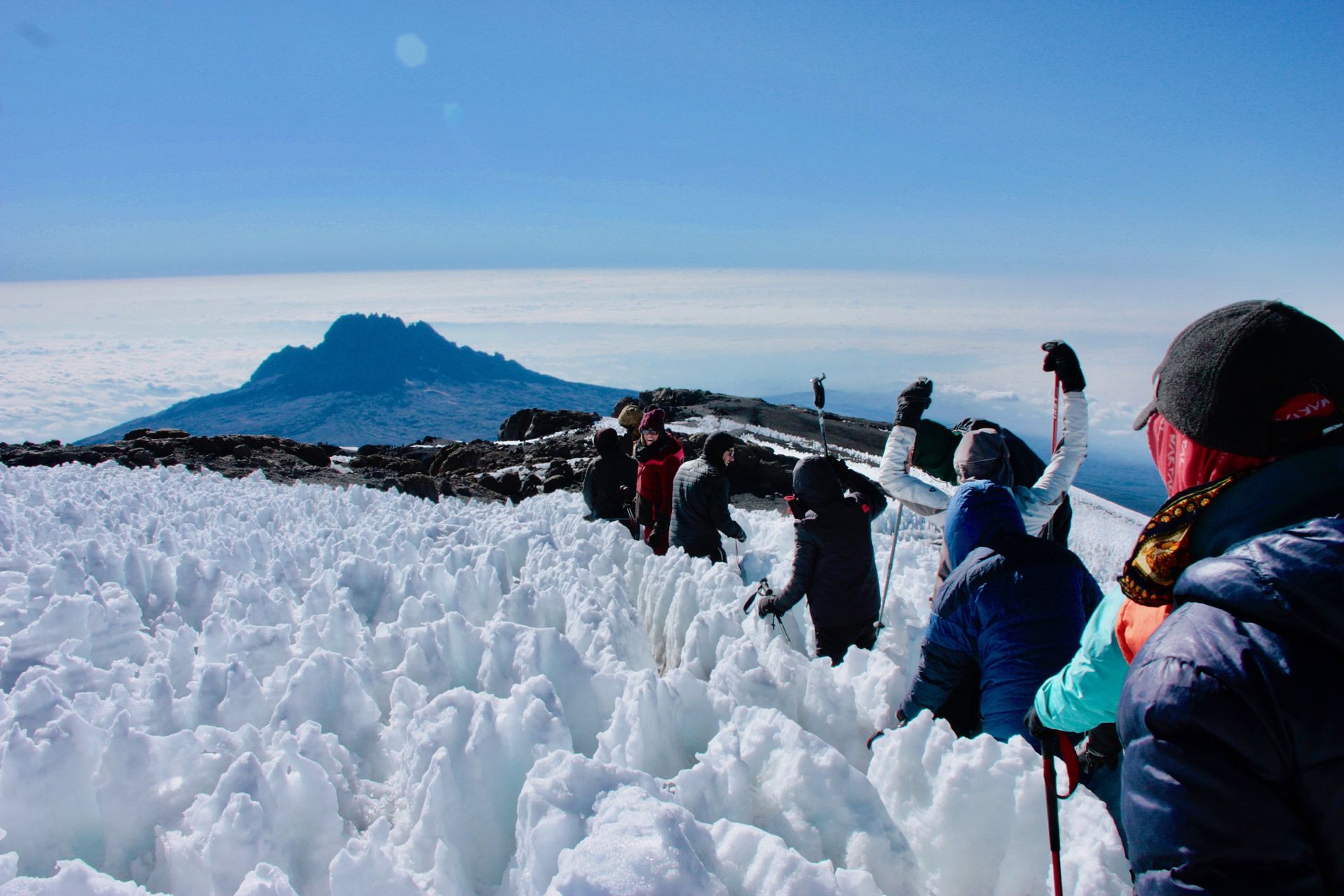
The hardest day of your life so far, almost certainly. You leave Kibo at midnight under a sky thick enough with stars to read by, single-file, head-torches making a slow chain of yellow dots up the scree. Temperatures are typically -10C to -20C with the wind chill. The trail up to Gilman's Point on the crater rim at 5,681m takes most trekkers five to seven hours and follows endless zig-zags up loose volcanic ash - one step, half a step back, repeat ten thousand times. This is where the mountain is genuinely hard. The cold, the thin air, the dark, the monotony and the slow grinding climb combine into something most people have never asked of themselves. Most trekkers cry, or want to. Cresting Gilman's Point as the sun rises behind Mawenzi - now far below you - is one of those memories that does not fade. From Gilman's it is another 60 to 90 minutes along the gently rising crater rim to Uhuru Peak - 5,895m, the highest point in Africa, the iconic green sign, the receding Northern Icefields right beside you, the curve of the earth on the horizon. On a clear morning you can pick out Mt. Kenya 250km to the north. Time at the summit is brief: 15 to 30 minutes of photos, then your guide turns you around. The descent back to Kibo is a controlled slide down the scree on legs already empty. After a brief rest and hot lunch, you continue down the Marangu trail to Horombo Hut at 3,720m - another three to four hours through alpine desert turning back to moorland. Total time on your feet: 12 to 14 hours.
- Gilman's Point on the crater rim at sunrise
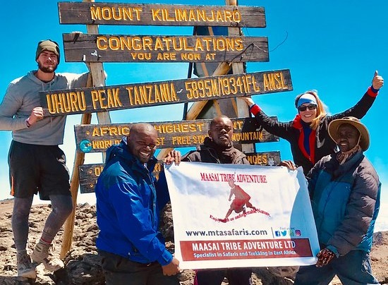
- Uhuru Peak - the Roof of Africa at 5,895m
- Possible Mt. Kenya view 250km to the north
Horombo Hut to Marangu Gate
A bittersweet morning. After a proper sleep at 3,720m - your first in days - you wake stiff and elated and a little disoriented. The trail drops down the southern side of the mountain via the Marangu route, which Rongai trekkers share for descent only. You walk back through the heather moorland, then the giant senecio belt, then the cloud forest, then the lower rainforest - effectively the whole vertical menagerie of the south slope in one morning. The descent is gentle in grade but steady in distance: 1,860m down over about 20 kilometres, slippery in places, hard on knees that already filed their complaints yesterday. Plan for five to six hours. Somewhere on the way down the porters will gather around you and sing the Kilimanjaro song - Jambo, jambo bwana, habari gani, mzuri sana - and you will not know what to do with your face. At Marangu Gate (1,860m) you sign out of the park and receive your certificates: gold for Uhuru Peak, green for Gilman's Point. A vehicle is waiting; the drive back to Moshi takes one hour. Most travelers go straight to a long shower, then order a steak and a cold beer.
- Descent through every southern ecosystem
- Kilimanjaro song from the porters
- Summit certificate at the gate
Elevation Profile
What you'll see
Sighting probability across all parks visited.
Elephant tracks (lower slopes)
Possible
Cape buffalo tracks
Possible
Bushbuck
Likely
Klipspringer (on the Saddle)
Possible
Four-striped grass mouse
Common
Lammergeier (bearded vulture)
Possible
White-necked raven
Common
What a typical day looks like
- 06:30
Wake-up tea brought to your tent
- 07:00
Breakfast: pancakes, eggs, porridge, fruit, hot drinks
- 08:00
Break camp, set off pole pole
- 12:30
Hot lunch stop: sandwiches, soup, fruit
- 15:00
Arrive at next camp (varies by day)
- 16:00
Popcorn, peanuts, ginger tea in the mess tent
- 18:30
Dinner: rice/pasta/ugali with stew, soup starter, hot drinks
- 20:00
Briefing for tomorrow, lights out
Fitness & Acclimatization
Fitness Required
Rongai is challenging but achievable for most reasonably fit adults. You do not need to be an athlete. What you do need is the capacity for sustained, slow effort at altitude - five to seven hours of walking per day with a daypack of 4 to 5 kg, followed by one very long summit night of 12 to 14 hours on the move. A useful baseline: you should be able to walk briskly for five to six hours at sea level, climb 200 stairs without resting, and recover with about ten minutes of rest. Day 2 (Simba to Kikelewa) is the longest pre-summit day at 12km / 6-7 hours of moderate climbing, and summit day is 18km over 12-14 hours including a 1,200m midnight scree climb. We recommend a 12-week preparation programme: three cardio sessions per week (hiking, running, stair-climbing, cycling), two strength sessions focused on legs, glutes and core, and a long weighted hike every weekend - start with 5km carrying 3kg and build to 15km carrying 6kg. If you live near hills, use them; if not, the Stairmaster is your new friend. Altitude is the wildcard. No amount of sea-level training fully predicts how you will respond above 4,000m - genetics play a role we cannot test for in advance. Generally speaking, anyone who can comfortably run a 10K can summit Kilimanjaro on Rongai. People who can run marathons are not automatically better positioned: recovery between days matters more than peak speed, and patience matters more than power. The most important thing is to arrive at the gate having done the work. The mountain rewards the prepared.
Acclimatization Strategy
Rongai's acclimatization profile is genuinely good - better than 5-day Marangu, comparable to 6-day Machame, and only modestly behind 7-day Machame. The 6-day route uses three specific techniques. First: a built-in acclimatization day at Mawenzi Tarn. Day 3 climbs only 680m to 4,330m, leaving an afternoon for a short climb-high-sleep-low walk onto Mawenzi's lower slopes (climbing to about 4,500m and returning to sleep at 4,330m). That single cycle kickstarts the red-blood-cell response without forcing you to sleep at higher altitude before ready. Second: a relatively gentle vertical profile in the first three days - just 2,380m of net gain over 25km, well-spaced. Third: pole pole pacing throughout. Your guide will hold the group to a deliberately slow walking pace, especially on days 2 and 3, which feels frustrating at first and then makes sense. The 7-day Rongai variant (adding an extra night at Mawenzi Tarn for a longer acclimatization walk) pushes summit success from ~75 percent to ~85 percent and is worth considering if you can spare the day. Symptoms to watch for: mild headache, mild nausea, sleeplessness and shortness of breath are all normal and expected above 3,000m. Severe headache that does not respond to ibuprofen, persistent vomiting, confusion, loss of coordination, ataxia (drunken-looking walk), or a wet cough are emergency symptoms that mean immediate descent. All our guides carry pulse oximeters and check every trekker twice daily; readings get logged. We carry emergency oxygen, a Gamow bag (portable hyperbaric chamber), and have evacuation protocols rehearsed. We will turn anyone around who is unsafe - the summit is always optional, getting down alive is not.
What's Included
- Park & rescue fees
- Mountain guides
- Cooks
- Porters
- Tented accommodation on the mountain
- All meals on the mountain
- Airport & hotel transfers
- Filtered drinking water
Not Included
- International flights
- Tanzania visa
- Tips for guides, cooks and porters
- Personal trekking gear (rental available)
- Alcoholic & soft drinks
- Travel & medical insurance
Before you go
FAQ
What is the summit success rate on the 6-day Rongai?
Why choose Rongai over the southern routes?
How quiet is Rongai really?
How cold is summit night?
Will I see wildlife?
Do I need to use Diamox?
Can I rent gear in Tanzania?
How much should I tip the crew?
You might also like
Kilimanjaro - Marangu Route (5 Days)
The 'Coca-Cola Route' - the oldest and most well-established route. The only route with hut accommodation (dormitory style) rather than tents. The shortest route to the summit.
Kilimanjaro - Machame Route (7 Days)
The 'Whiskey Route' - a popular, scenic route known for better acclimatization ('climb high, sleep low'). Accommodation is in tents. Approaches from the southwest.
Kilimanjaro - Lemosho Route (8 Days)
Starts on the western flank. Long route allowing excellent acclimatization. Joins the Machame route on Day 3.
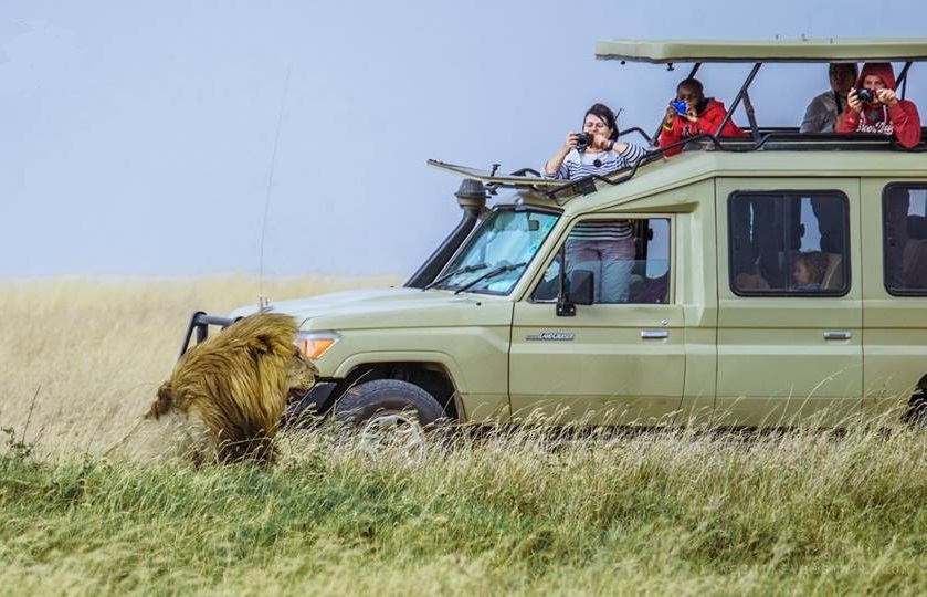
5-Day Tanzania Luxury Safari
A relaxed pace visiting Lake Manyara, Serengeti (2 nights), and Ngorongoro. Premium accommodations and exclusive experiences.
Ready to start planning your adventure?
Kilimanjaro - Rongai Route (6 Days)
Free cancellation: 60 Days